Meteo France Nos produits et services
NAVICAP : Marine weather
Marine forecast intended for display in harbors and marinas for all mariners, on display in fishing ports for fishermen and at Ferries. Available in French and in English.
The Navicap exists in two forms: dynamic animations broadcast on a screen (based necessarily on an extranet, see the tabs below) or in a PDF format intended for display (see the example below). It can consist of:
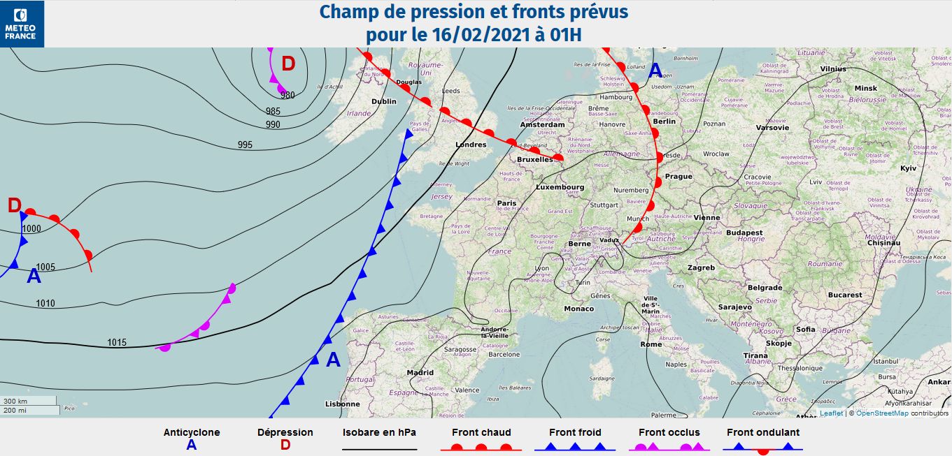
- Pressure maps with front systems on Europe-Atlantic
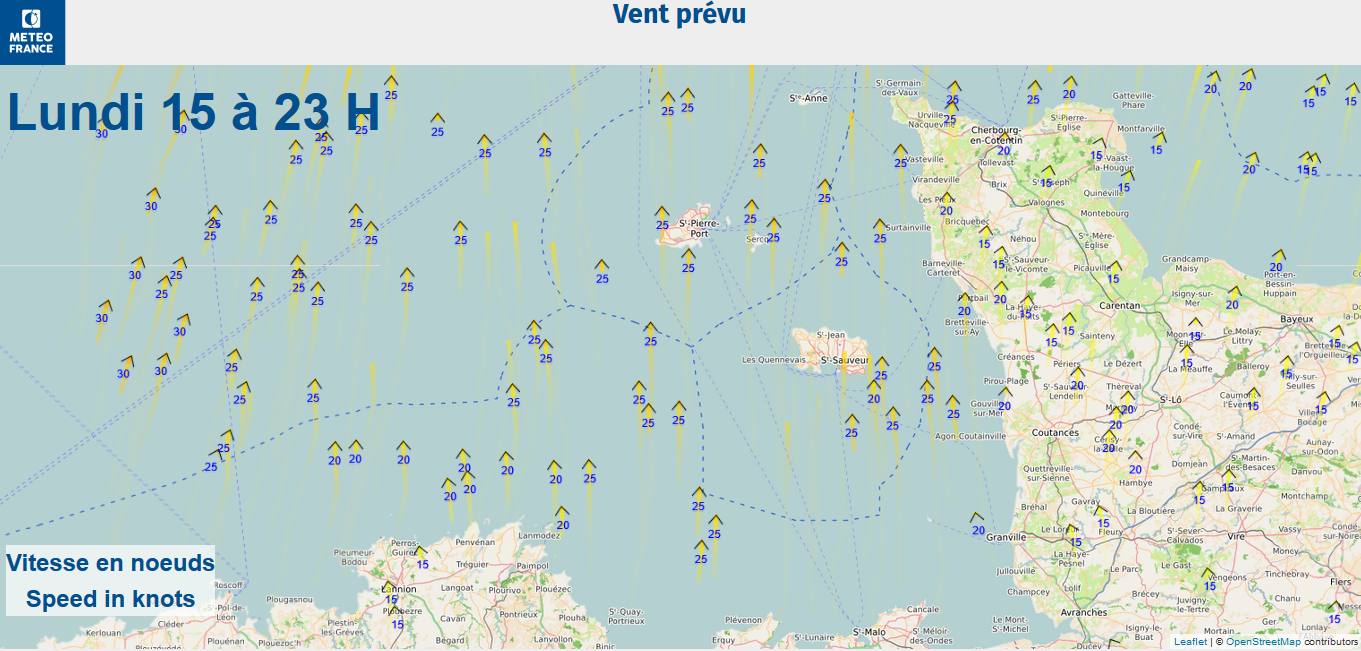
- Model wind forecast maps (choice of model available)
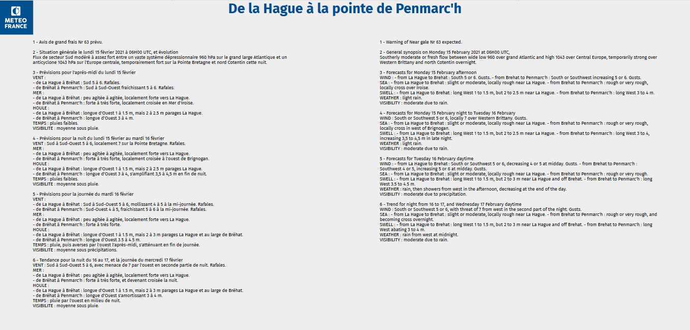
- Bulletins (coastal safety, shore, offshore) : description of wind, temperature, sea state, visibility parameters...
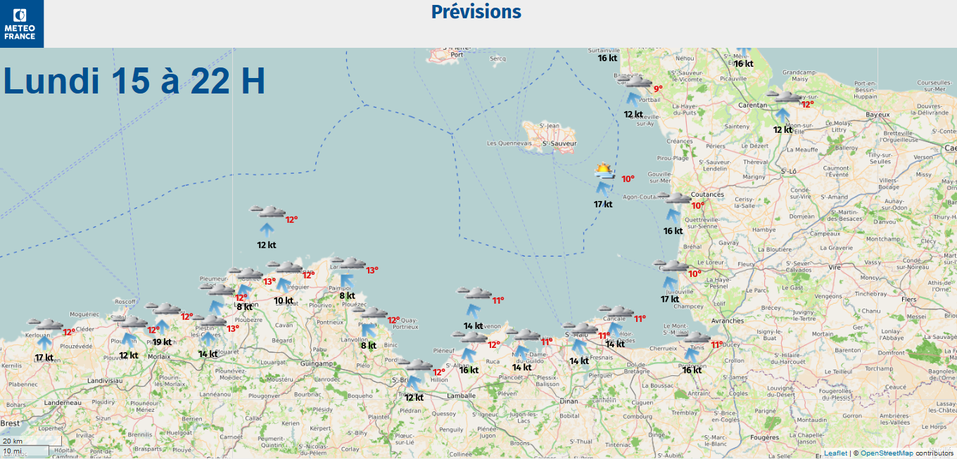
- Evolution of the main meteorological parameters in pictogram
Available overseas in screen format.
- Chart and pictogram (animated)
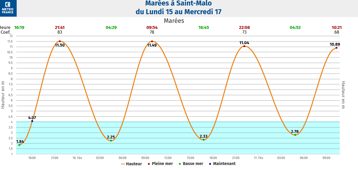
- Tide (animated)
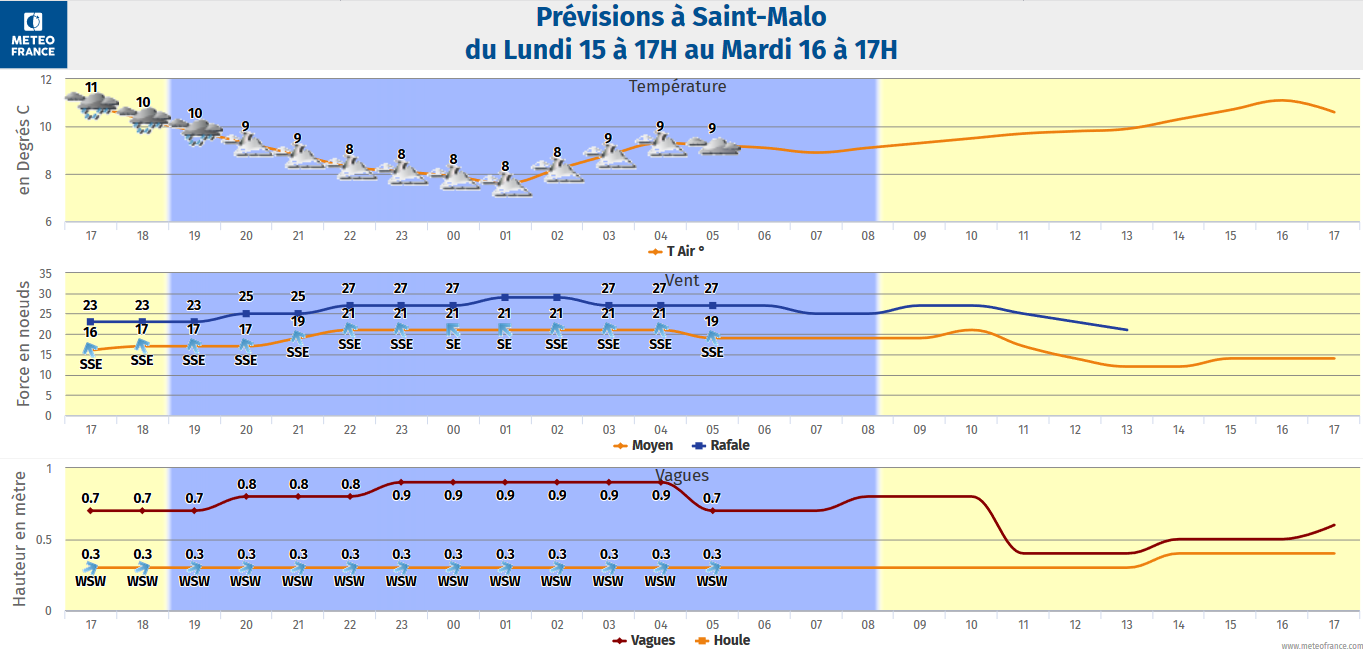
- atmogram : temperature, wind, wave (animated)
- Coastal bulletin
- Wind (animated)
- Pressure field and fronts (animated)